Last weekend we made a small bike tour with our eBikes. To prepare the planned route I created it online an loaded it to my smartphone. I don’t use my smartphone to navigate but I like it to use it like a map with the route painted on it. In this post I describe my solution to create a track and follow it with my phone. I recommend to read the documentation especially of GPSies and OruxMaps maybe you can find a better way than I. But currently I like the way it worked, especially the part with the QR code on GPSies which is an super easy way to bring the track I created at my computer to my phone.
I used the following websites and apps
My setup is the following
- Installed OruxMaps on my phone
- loaded the maps of my region from openandromaps to my phone for use with oruxmaps
- At first you have to install the openandromaps render theme
- I loaded the maps to my phone via my computer (or you can also try to load the maps with your phone directly)
- Create an account at GPSies.com
Track creation and recording
I created the track at GPSies.com and could manage it without reading the help pages. I think GPSies website is usable quiet intuitive. And I came up with the following route.
And when you look at the bottom of the page of your track at GPSies there is a QR-Code. I scanned this QR code with my phone and opened the URL in a browser. Then download the gpx-Track and open it. My phone suggests automatically to open the track with Orux Maps. But sometimes this does not work so I open the downloads folder and try to open the gpx file from there. Then I choose in OruxMaps the options ‘No navigation’ and ‘No recording’. Then the following screen shows up:
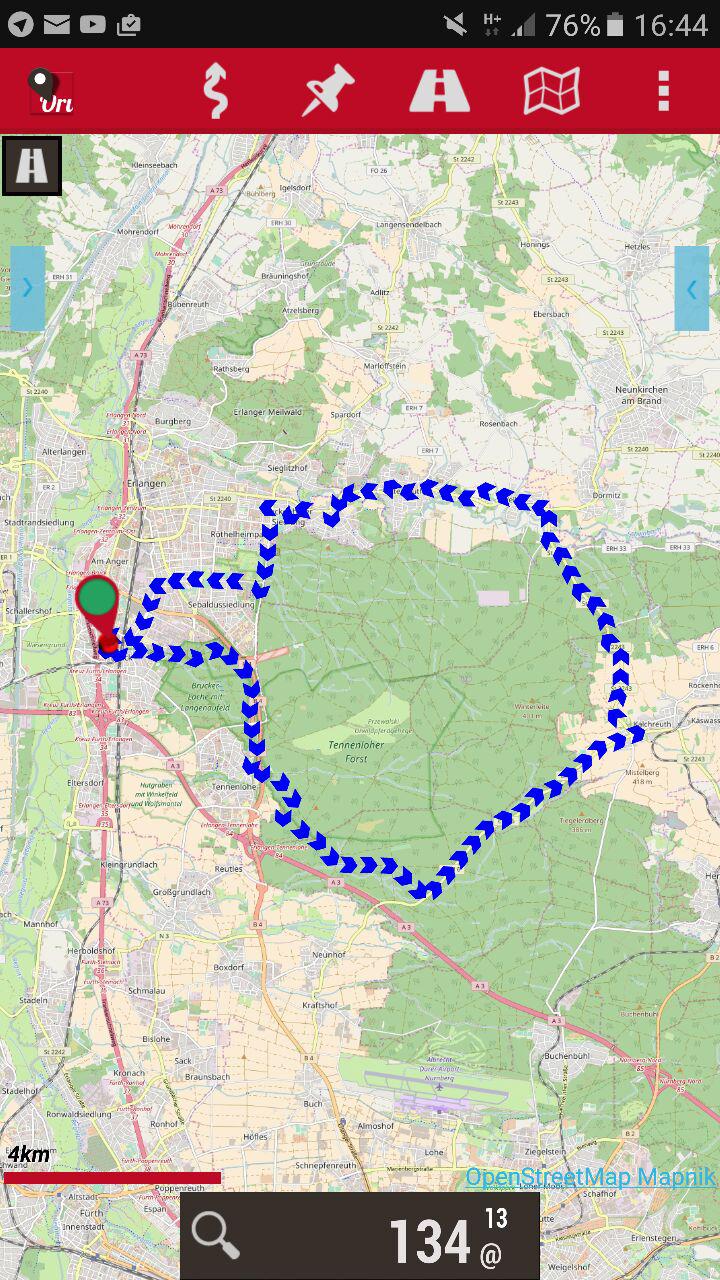
Loaded track in OruxMaps
When we started our tour I started recording in Orux Maps to track our tour.

Orux Maps start recording
Unfortunately I don’t started it at the beginning of the tour. Instead I realized it at the half way and started recording then. In the following picture you can see the red line which is the second half of our tour. There is a small red arrow on the map which shows were you are at the moment when you are recording or if you have enabled gps in OruxMaps.
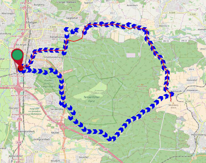
Second part of our tour (red line)
You can see that we left the planed path and took an other way through the wood 🙂
At the end of the trip when you stopped the GPS recording in Orux Maps (tip at the square which appears instead of the red recording point in the picture above) you can upload your recorded track to GPSies. You can upload your track in the ‘manage tracks’ view when you tip on the track and choose upload to (you have to enter your GPSies crendentials the first time you do this). This is the Point where the circle closes.
Here is the part of our Tour which was recorded:
Remark about embedding maps via iframe
When I embedded the maps from GPSies on this post via iframes I have to use https (ssl) links otherwise the browsers would not show the contents of them. When you open the site via http and include the iframe links with https there seems to be no problem.
Raised flower Bed 2017-02-12
Raised flower bed – 2017-02-12